Eagle Plains Commences 2015 Exploration in Seabee Gold Mine Area, Saskatchewan
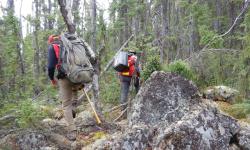
Saskatchewan | June 30, 2015Cranbrook, B.C., 30 June, 2105: Eagle Plains Resources Ltd (TSX-V:EPL) has mobilized crews to commence geological fieldwork on several 100% EPL owned projects in the Seabee Gold Mine area, approximately 130 km northeast of La Ronge, Saskatchewan. The projects include Eisler Lake, Kettle Falls, Leyland West and Maynard Lake. All of the claims comprising the projects were acquired by staking by Eagle Plains and carry no underlying royalties or encumbrances. Phase One fieldwork is being carried out by TerraLogic Exploration Ltd. of Cranbrook, BC under the supervision of Jarrod Brown, P.Geo., and is expected to take three-four weeks to complete.
The target for the 2015 work is mineralization similar to that at the Seabee and Santoy Gap deposits. The Seabee mine is owned by Claude Resources Inc. and has been in operation since 1991, producing a total of 1 million ounces as of August, 2012 at an average grade of 0.23 oz/ton Au (7.89 g/t). The Santoy Gap, also owned by Claude, has been in production since 2014. Management cautions that past results or discoveries on proximate land are not necessarily indicative of the results that may be achieved on Eagle Plains’ properties.
Eisler Property Highlights
- 4970 ha, contiguous to Seabee property with similar geological setting and mineralization
- Hosts gold mineralized shear zone ranging from 3.9 to 18.7 m width over 2.5 km strike length
- Historic diamond drilling returned up to 4.0 g/t Au over 4.5 m at DD occurrence
- Numerous geophysical and geochemical targets remain untested
Exploration on the Eisler Lake property to date by past operators has focused on the DD occurrence, which consists of intrusive rocks equivalent to those which host Seabee ore-bearing structures. Chip sampling in 1986 across the main DD-showing shear systems returned 6 strongly anomalous samples with assays between 1.02 to 7.36 g/t Au. A follow-up 21 hole diamond drill program completed in 1987 intercepted numerous shear hosted quartz veins with anomalous gold values. Geophysical surveys traced the shear along strike for over 2.5 km, while diamond-drilling over 1.5 km of strike-length defined the shear zone ranging from 3.9 to 18.7 m true width. Anomalous assays from 9 holes testing this shear system ranged between 0.96 g/t to 9.86 g/t Au. One of the best intercepts in hole 87-15 returned 4.0 g/t Au over 4.5 m.
Kettle Falls Property Highlights
- Original 2013 property area of 3400 ha, located 25km southeast of Seabee with limited historical systematic exploration.
- Increased property area to 6473 ha following encouraging 2013-2014 field results
- 2014 work by Eagle Plains located high-grade mineralization in greenstone rocks with grab-samples up to 9.2 g/t Au
- Prominent mineralized shear structure identified over 300m on surface, ranging from 1-3 m in width. Property underlain by kilometer-scale shear zone
The Kettle Falls Property is underlain by metavolcanic (greenstone) and metasedimentary units of the Glennie Domain. The property is transected by the N-S trending Tabbernor Lake fault system – a major crustal shear system transecting the Trans Hudson orogeny, that has been traced over 1500 km from the Wollaston Lake area of northern Saskatchewan to North Dakota. Eagle Plains completed 26 field-person days on the property in 2014 which yielded encouraging results. Two grab samples from sheared volcanic rocks from the northern half of the property returned 1120 ppb Au and 9190 ppb Au, while a 3rd sample from south of the falls returned 588 ppb Au. Follow-up channel sampling of the new WTF showing, located approximately 1 kilometre northwest of Kettle Falls, returned an overall average of 1395 ppb Au and 342 ppb Ag over 8.0 m including 1964 ppb Au over 2 m and 2054 ppb Au over 1.5 m. The best channel sample result was 13261 ppb Au over 0.5m. At the WTF showing there is a pronounced alteration zonation in the host volcanic rocks over 10 m, indicating significant fluid flow and providing a promising vector to target future work in this underexplored area.
Leyland Property Highlights
- Gold mineralization hosted in quartz veins and greenstone volcanics
- Mineralization reported over 3 km strike with grab samples up to 51 g/t Au
- Geological setting and mineralization similar to that at nearby Seabee Mine
- Numerous geophysical and geological targets remain untested
Three significant zones of gold mineralization are known in the Leland property area. From east to west they are: 1) Shear-hosted quartz veining in the Duck Lake granodiorite (SMDI 1731) with up to 3.2 g/t Au; 2) Shear-hosted quartz veining in magnetic mafic volcanics along the south shore of Leland Lake (SMDI 2390) with up to 8.6 g/t Au; and 3) Mineralized quartz veining and host volcanics in 3 parallel sub-conformable shear zones within and along contacts of metavolcanic and metagabbro lithologies which occur on strike between Irving Lake (SMDI 1732) and Simon Lake (SMDI 2388). This zone has more than 15 anomalous samples reported over 300 ppb Au, with up to 51 g/t Au.
The Simon Lake and Irving Lake showings define part of a 3 km x 700 m mineralized corridor within the property and is the prime target for follow-up exploration in 2015 to better define the extent of mineralization and to refine future drill targets.
Maynard Lake Property Highlights
- 922 ha property located 80 km south of Seabee, underlain by kilometer-scale shear zone
- Gold mineralization found both in quartz veins and sheared diorite host rocks.
- Historical grab samples to 33 g/t and 17 g/t over 1.0 m in drill core
- Trenching and drilling verified mineralized strike length over 300 m
- 800 m gold-in-soil geochemical anomaly open to east and south
- Analogous to mineralization at Seabee Mine and Star Lake Mine
- Numerous geochemical and geophysical targets remain untested
Regionally, the Maynard Lake Property is underlain by an east-west trending and steeply dipping assemblage of metamorphic rocks. Three gold showings have previously been discovered in the Maynard lake area. The most significant of these, the M-10 (SMDI 1729), is associated with heterogeneously sheared diorite along the southern margin of the Maynard Creek Pluton flanking the Hartley Shear Zone. Gold mineralization is typically shear-hosted quartz veinlets associated with pyrite-arsenopyrite and rare chalcopyrite. Rock samples collected in 1988 to 1989 from the trenches by G Delaney and Carina Resources returned anomalous results of 370, 800, 2310, and 33000 ppb Au. Diamond drilling in the same period returned moderate to strong gold anomalies occurring in five of the six holes. Visible gold was noted in M10-88-02. Best intercepts over 1 m intervals included 5.1 g/t Au (hole M10-88-01), 17 g/t (88-02), 3.7 g/t (88-03), 5.0 g/t (88-04), and 4.0 g/t (89-02) within a 5.6 m shear zone that averaged 1.5 g/t Au. Gold mineralization was noted up to 4 m into the hanging wall and footwall of the shear.
Technical aspects of this news release were prepared by Jarrod Brown, P.Geo.
About Eagle Plains Resources
Based in Cranbrook, B.C., Eagle Plains continues to conduct research, acquire and explore mineral projects throughout western Canada. The Company is committed to steadily enhancing shareholder value by advancing our diverse portfolio of projects toward discovery through collaborative partnerships and development of a highly experienced technical team. The company’s current focus is to preserve its robust treasury while advancing its most promising projects. In addition, Eagle Plains continues to seek out and secure high-quality, unencumbered projects through research, staking and strategic acquisitions. Throughout the exploration process, our mission is to help maintain prosperous communities by exploring for and discovering resource opportunities while building lasting relationships through honest and respectful business practices.
Expenditures from 2011-2014 on Eagle Plains-related projects were approximately $15M, which was funded by Eagle Plains and for the most part, by third-party partners. This exploration work resulted in approximately 15,000 m of diamond-drilling and extensive ground-based exploration work facilitating the advancement of numerous projects at various stages of development.
Jarrod Brown, P.Geo. has reviewed and approved the technical contents of this news release.
On behalf of the Board of Directors
“Tim J. Termuende”
President and CEO
For further information on EPL, please contact Mike Labach at 1 866 HUNT ORE (486 8673)
Email: mgl@eagleplains.com or visit our website at https://www.eagleplains.com
Cautionary Note Regarding Forward-Looking Statements
Neither the TSX Venture Exchange nor its Regulation Services Provider (as that term is defined in the policies of the TSX Venture Exchange) accepts responsibility for the adequacy or accuracy of this release. This news release may contain forward-looking statements including but not limited to comments regarding the timing and content of upcoming work programs, geological interpretations, receipt of property titles, potential mineral recovery processes, etc. Forward-looking statements address future events and conditions and therefore, involve inherent risks and uncertainties. Actual results may differ materially from those currently anticipated in such statements.
Latest News Releases

Eagle Plains Partner Earthwise Commences Fieldwork at the Iron Range Gold Project, British Columbia

Eagle Plains and Ya’thi Néné Lands and Resources Add George Lake Project to Exploration Agreement


