Karin Lake Project
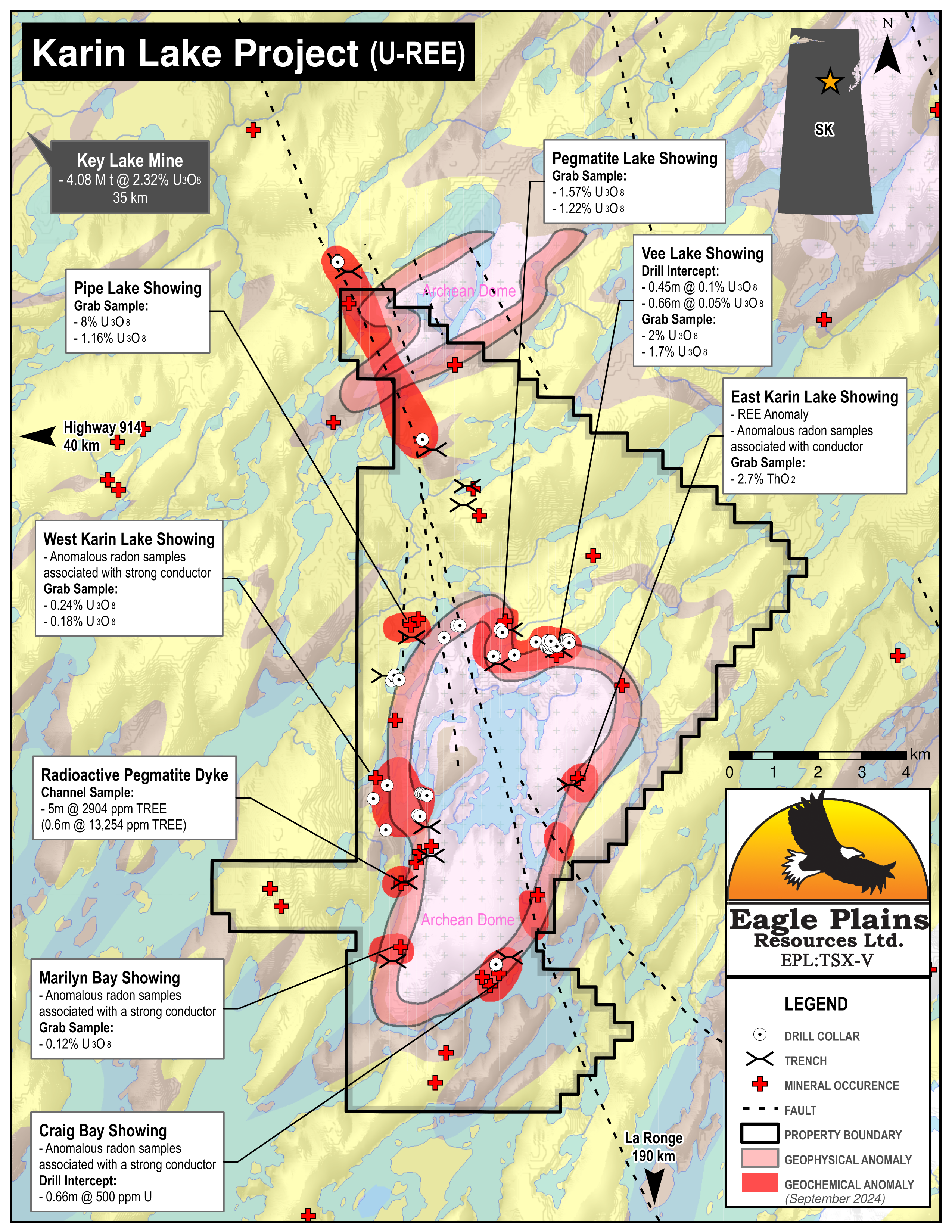
The 12116ha Karin Lake Property is located 190 km north of La Ronge and 40 km SE of the Key Lake Mine in northern Saskatchewan. Cameco’s Key Lake Mine road, 30 km to the west, provides a staging area for this float plane accessible property. Positioned 15 km south of the Athabasca Basin margin, the project and is prospective for Uranium and Rare Earth Elements (REE’s) mineralization.
-
- Saskatchewan
-
- Available for option: Yes
-
- Rare Earth Elements,
- Uranium
Project Highlights
- Excellent geology favourable for uranium deposits
- Significantly underexplored with encouraging early results
- Targets for multiple deposit models, including basement unconformity and alaskite (Rossing-type) uranium
- Multiple untested geophysical anomalies associated with favourable geology and structure
- Large property package
Summary
The 12,116 ha Karin Lake Property is located 190 km north of La Ronge and 40 km SE of the Key Lake Mine in northern Saskatchewan. Cameco’s Key Lake Mine road, 30 km to the west, provides a staging area for this float plane accessible property. This Rare Earth Element (“REE’s”) and Uranium project lies 15 km south of the Athabasca Basin.
Project Highlights
- Excellent geology favourable for uranium deposits
- Significantly underexplored with encouraging early results
- Targets for multiple deposit models, including basement unconformity and alaskite (Rossing-type) uranium
- Multiple untested geophysical anomalies associated with favourable geology and structure
- Large property package
Geology
The property contains 19 known mineralized showings and lies entirely within the Wollaston Domain. The Athabasca Basin, 15 km to the north, hosts predominantly Proterozoic sandstone lithologies, which lie unconformably above the Wollaston and Mudjatik Domains. The world-class uranium mines such as Key Lake, McArthur River, Cigar Lake, and Eagle Point are all spatially associated with this unconformity, and host significant resources found in the ‘basement’ lithologies of the Wollaston and Mudjatik Domains.
History
Between 1967 and 1989 exploration was dominantly Uranium focused. These programs were successful in locating many of the showings known today and delineating a continuous EM conductor of 20 km surrounding the domal Archean basement. The best results to date are from a trench at the Pipe Lake Showing where a high-grade sample comprising pitchblende in joint fractures returned 8.0% U3O8.
Eagle Plains Exploration
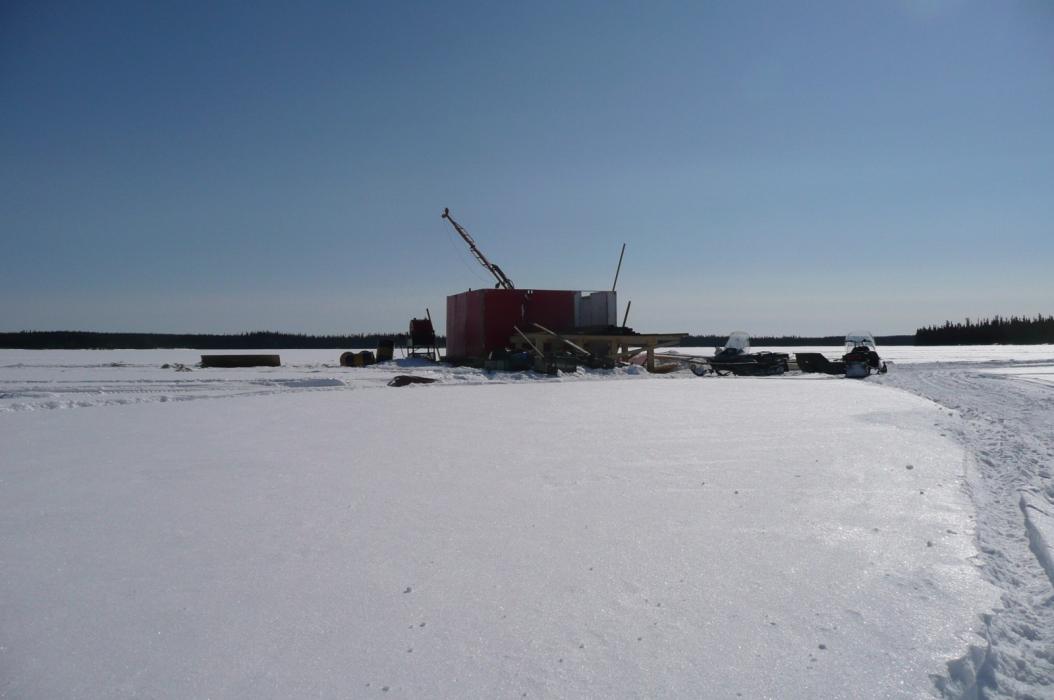
Between 2006 and 2012 Eagle Plains has conducted 5 exploration programs focussing on U mineralization with some success. In 2012, two drill holes revealed anomalous REE’s while testing the well-defined EM conductor and coincidental geochemical anomalies under west Karin Lake. Two km south along the same stratigraphic/structural horizon, a newly discovered pegmatite sill returned 2,904 ppm TREE over 5.2 m (including 13,254 ppm TREE over 0.6 m). Mapping and geophysics indicate these are correlative to each other.
Future Work
The 2012 diamond drilling program at Karin Lake confirmed the presence of lithological and structural features that are favourable precursor elements for basement unconformity hosted uranium deposits. Detailed prospecting/mapping and scintillometer surveys are recommended for uraniferous and REE showings throughout the property.
It is also recommended that portions of the historical drill core, stored in La Ronge, be assessed for REE’s.
Eagle Plains - A Project Generator
Eagle Plains Resources is a project generator with several mineral exploration properties of merit that meet qualifying transaction requirements. We facilitate the listing process for capital pool companies and initial public offerings while providing technical expertise for exploration programs. Companies interested in co-operatively exploring any of our projects please contact: Chuck Downie at ccd@eagleplains.com or Mike Labach at mgl@eagleplains.com or call 1 866 Hunt Ore (486 8673).
The Karin Lake project is currently available for option.
Details
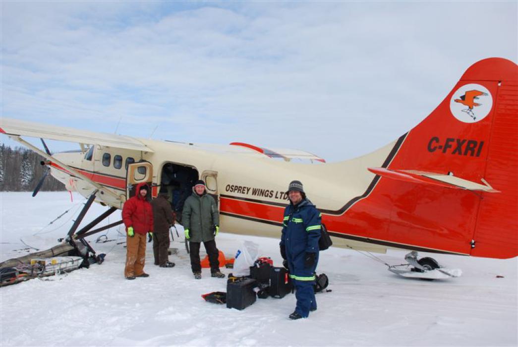
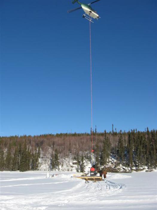
The 12,116 ha Karin Lake Property is located near Upper Foster Lake in northern Saskatchewan, 190 km north of La Ronge and 35 km SE of the Key Lake Mine. It is accessible by float plane and helicopter with Cameco’s Key Lake Mine road located 30 km to the west providing a staging area for work programs. The SE margin of the Athabasca Basin lies approximately 15 km to the north of the property.
The property is being explored Rare Earth Elements (REE’s) and Uranium. The claims were staked in 2006 and are 100% owned by Eagle Plains with no underlying royalties or encumbrances.
Project Highlights
- Excellent geology favourable for uranium deposits
- Significantly underexplored with encouraging early results
- Targets for multiple deposit models, including basement unconformity and alaskite (Rossing-type) uranium
- Multiple untested geophysical anomalies associated with favourable geology and structure
- Large property package
Geology
The Karin Lake Property contains 19 known mineralized showings and lies entirely within the Wollaston Domain, a NE-trending, tightly folded, linear belt of supracrustal rocks, and interfolded remobilized granitoids that form a core of gneissic dome structures along the Trans-Hudson Orogen. The supracrustal rocks in the property region, known formally as the Wollaston Group, feature a basal, graphitic pelitic unit overlain and in part intercalated with arkose, subordinate conglomerate, quartzite, and calcareous sediments. The succession overlies late Archean granitic gneiss, extending SW from northern Manitoba, through Wollaston Lake, and beneath the Phanerozoic strata of the Western Canada Sedimentary Basin.
The present day margin of the Athabasca Basin occurs 15 km NNE of the property area. The basin hosts predominantly Proterozoic sandstone lithologies, which lie unconformably above the Wollaston and Mudjatik Domains. The world class uranium mines such as Key Lake, McArthur River, Cigar Lake, and Eagle Point are all spatially associated with this unconformity, and host significant resources found in the ‘basement’ lithologies of the Wollaston and Mudjatik Domains.
History
In 1967 Great Plains Development conducted an airborne radiometric survey and followed up in 1969 with prospecting, mapping, radon sampling, trenching and drilling. The best results were obtained from trenching at the Pipe Lake showing where a high grade sample comprising pitchblende in joint fractures returned 8.0% U3O8.
In 1970, prospecting, mapping and Radon 222 sampling was conducted over radiometric anomalies of the Upper Foster Lake region to determine the source of radioactive boulders in the area. Mapping, geophysics, trenching and drilling were conducted.
Following the discovery of uranium-nickel ore at Key Lake in 1975, regional mapping was carried out over large parts of area, geological and structural similarities between the Key Lake deposit and the Karin Lakes area were highlighted.
In 1977, Denison Mines Ltd. conducted airborne geophysics over much of the Karin Lake region. Mapping, prospecting and radiometric surveys followed. Drilled was conducted to investigate radioactive showings and conductors. All 4 holes encountered pelitic graphite-bearing schists which explained the local EM anomalies, but no radioactive zones were encountered.
Follow-up winter work in 1978 investigated EM conductors using ground-based geophysics that located a continuous conductor of 20 km surrounding the domal Archean basement. In 1979, 29 drill holes tested the radioactive showings and conductors and no significant radioactivity was encountered. This was followed by a summer program of ground-based geophysical surveys, radon gas and soil sampling. The best sample came from a trench returning up to 1.57% U3O8 in pegmatite biotite gneiss associated with biotite schist.
In 1981, Dennison Mines conducted geophysical and geological surveys and outlined a 5 station EM anomaly, enveloped in magnetic “troughs”, and further further work was recommended but not completed.
During 1979, two different parties were conducting work on the northern part of the Karin Lake. Geophysical, scintillometer and geologic surveys defined several geophysical conductors near known U-mineral occurrences but the recommended drilling was not conducted.
In 1989, regional mapping and sampling was carried out on an Athabasca-basin-scale and followed by detailed stratigraphic and structural mapping covering the Karin Lake to Burbidge Lake areas.
Eagle Plains Exploration
Fieldwork and airborne geophysical surveys were completed by Eagle Plains during the 2006 and 2007 field seasons. All of the known 19 showings received cursory to detailed examinations.
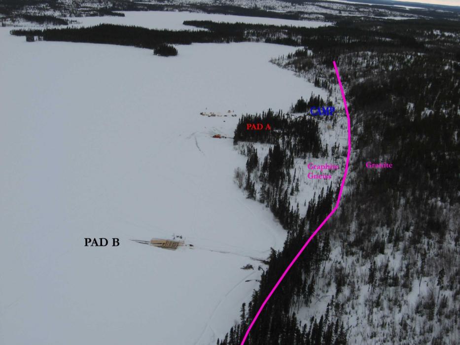
In 2008, 8 short holes for a toal of 750 meters of diamond drilling at the Craig Bay Showing, followed by reconnaissance target evaluation and regional mapping, rock sampling, lake-bottom sediment sampling, Radon-in-water sample collection and in-situ Radon-in soil analysis. Of the 8 holes drilled along a 1 km strike-length six encountered anomalous gamma counts at or near the base of graphite-rich metasediments of the Wollaston Group, in contact with basement granite and pegmatite along the margin of the Archean Karin Lake Inlier. The best intercept returned 500 ppm U over 0.66 m. Several of the mineralized occurrences within the metasediments indicate an association with Co, Cu and Zn.
Field work in 2010 included rock, radon in lake/bog, soil and radon-in-soil sampling. Mapping, prospecting and scintillometer traverses were carried out as well. The aim was to provide detailed property-scale work near under-explored known showings, prospect and sample along unconformities marginal to the Karin Lake and Crow Lake granitoid domes, and prospect 10 new areas of interest based on previous results. A new radioactive pegmatite occurrence was discovered on a peninsula in the central portion of the property. A grab sample from this 4+ m wide pegmatite sill returned 5690 ppm TREE.
2012 Eagle Plains Exploration Program
Two drill holes tested the well-defined EM conductor in an area of coincident geochemical anomalies under west Karin Lake. The highest uranium value was 25 ppm U. Thorium and REEs were anomalous in several samples, ranging 7-985 ppm Th, and 51-6484 ppm TREE.
A channel sample was taken across the entirety of the pegmatite sill discovered in 2010. It returned values of 2,904 ppm TREE over 5.2 m (including 13,254 ppm TREE over 0.6 m). Mapping and geophysics indicate that the west Karin lake REE-Th mineralized pegmatite units, which may exceed 14 m true thickness, are correlative to these mineralized pegmatites.
Future Work
The 2012 diamond-drilling program in west-Karin Lake does confirm the presence of lithological and structural features that are favourable precursor elements for basement unconformity hosted U deposits. REE mineralization in pegmatites encountered in both the 2012 drilling and channel sampling lie along the same stratigraphic/structural horizon and are located 2 km apart.
Detailed prospecting/mapping and scintillometer surveys along this trend are recommended to followed up this REE mineralization. Other recommendations from earlier programs include geological mapping and scintillometer, soil geochemical and detailed lake-bottom-radon surveying to locate uranium mineralization.
Drill results in the 1950's did not return exceptional U results, but the core, available in La Ronge, has never been assessed for REEs. As such, it is recommended that some of the core be quartered and analyzed for REE content.
Eagle Plains - A Project Generator
Eagle Plains Resources is a project generator with several mineral exploration properties of merit that meet qualifying transaction requirements. We facilitate the listing process for capital pool companies and initial public offerings while providing technical expertise for exploration programs. Companies interested in co-operatively exploring any of our projects please contact: Chuck Downie at ccd@eagleplains.com or Mike Labach at mgl@eagleplains.com or call 1 866 Hunt Ore (486 8673).
The Karin Lake project is currently available for option.
Updated September 25, 2024
