MM Project
The 463 ha MM Project is situated in south-central Yukon 60 km south of Ross River. Work by past operators over 44 years has identified well-developed volcanogenic massive sulphide (“VMS”) mineralization and alteration. The property is also prospective for Rare Earth Elements (“REE’s”).
Access is by helicopter serviced from Ross River. Crews can be mobilized to the property from the Ketza River Mine road located 28 km NE of the property.
-
- Yukon Territory
-
- Available for option: Yes
-
- Rare Earth Elements,
- Copper,
- Silver,
- Zinc,
- Lead
Project Highlights
- Numerous high-grade showings and geochemical anomalies
- Excellent geology favourable for VMS poly-metallic deposits
- Significantly underexplored with encouraging early results
- Encouraging exploration to date with comprehensive database
- Drill ready
Summary
The 463 ha MM Project is situated in south-central Yukon 60 km south of Ross River. Work by past operators over 44 years has identified well-developed volcanogenic massive sulphide (“VMS”) mineralization and alteration. The property is also prospective for Rare Earth Elements (“REE’s”).
Access is by helicopter serviced from Ross River. Crews can be mobilized to the property from the Ketza River Mine road located 28 km NE of the property.
Project Highlights
- Numerous high-grade showings and geochemical anomalies
- Mineralized VMS horizon
- Significantly underexplored with encouraging early results
- Comprehensive database
- Drill ready
Geology
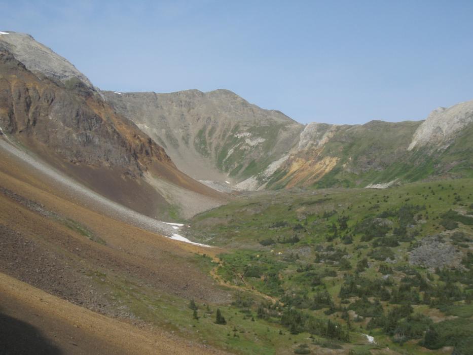
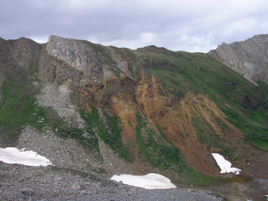
A well exposed cirque with significant vertical relief provides an excellent opportunity to establish relationships between three distinctive lithotectonic elements or “terranes” which underlie the immediate property area and are structurally stacked along low-angle thrust faults. Pelly Mountain Volcanic Belt (“PMVB”) rocks of interest in this area sit in part, tectonically below a package of Silurian to Devonian and Early Cambrian, phyllitic and carbonaceous sedimentary rocks along flat-lying thrust faults. The faulted contact above the PMVB rocks contains discontinuous, attenuated lenses of serpentinite.
History
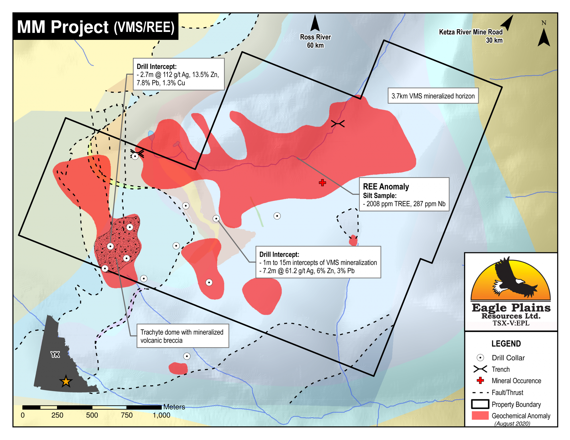
The MM property area was originally staked in 1970 and had 6 exploration programs on it through to 1996. These included mapping, geochemical and geophysical surveys, trenching and diamond-drilling as well as government studies. Some historical drill intercept highlights are as follows:
| Sample Type | Interval | Results |
|---|---|---|
| Drill | Various | Intercepts of VMS mineralization from 0.9m to 15.7m |
| Drill | 7.2m | 5.9% Zn, 3% Pb, 61.2 g/t Ag |
| Drill | 2.7m | 13.5% Zn, 7.8% Pb, 1.3% Cu, 112 g/t Ag |
Eagle Plains Exploration
Since acquiring the property in 2001, Eagle Plains has conducted 3 exploration campaigns, with the first 2 focusing on VMS-style mineralization and the latest evaluating REE potential. Exploration for VMS was encouraging concluding that exploration should focus on the eastern end of the property where the likelihood of locating contiguous stratabound mineralization is higher.
The REE exploration program revealed a significant downstream accumulation of the elements of interest culminating in a very significant 2008 ppm TREE and 287 ppm Nb. This anomaly coincides with other known stream silt anomalies for many other elements of interest. Previous work noted the potential for a significant buried structure of interest.
Future Work
Recommendations to define targets for diamond drill testing for VMS include detailed mapping, prospecting and soil geochemical sampling along the trend of the known VMS horizon to identify areas for detailed ground geophysics.
The areal extent of REE anomalies is significant and re-analyzing the historical silt-stream/soil pulps is recommended to determine the specific stratigraphy associated with REE mineralization.
Eagle Plains - A Project Generator
Eagle Plains Resources is a project generator with several mineral exploration properties of merit that meet qualifying transaction requirements. We facilitate the listing process for capital pool companies and initial public offerings while providing technical expertise for exploration programs. Companies interested in co-operatively exploring any of our projects please contact: Chuck Downie at ccd@eagleplains.com or Mike Labach at mgl@eagleplains.com or call 1 866 Hunt Ore (486 8673).
The MM project is currently availalbe for option
Details
The 463 ha MM Project is situated in south-central Yukon 60 km south of Ross River. Work by past operators over 44 years has identified well-developed volcanogenic massive sulphide (“VMS”) mineralization and alteration. The property is also prospective for Rare Earth Elements (“REE’s”).
Access is by helicopter serviced from Ross River. Crews can be mobilized to the property from the Ketza River Mine road located 28 km NE of the property.
The claims are 100% owned by Eagle Plains Resources and carry no underlying royalties or encumbrances.
Project Highlights
- Numerous high-grade showings and geochemical anomalies
- Mineralized VMS horizon
- Significantly underexplored with encouraging early results
- Comprehensive database
- Drill ready
Geology
In the central part of the property, rocks of the Pelly Mountain Volcanic Belt (“PMVB”) are exposed in a cirque with significant vertical relief. The younger volcanics sit tectonically below a package of Silurian to Devonian and Early Cambrian, phyllitic and carbonaceous sedimentary rocks along flat-lying thrust faults. The faulted contact above the PMVB rocks contains discontinuous, attenuated lenses of serpentinite. These three assemblages show a characteristic piggy-back style of thrusting in which stacking shows older over younger rock packages. As a result of the structural position of the youngest, Mississippian volcano-sedimentary succession, the rocks have largely been recrystallized and deformed.
History
The MM property area was originally staked by a Spartan EL - Mitsui Mining and Smelting joint-venture in 1970. The claims were re-staked in 1973 by Anvil Mining Corp. who conducted mapping, geochemical, magnetic and gravity surveys and four diamond-drill holes.
In 1975, Cyprus Anvil entered into a joint-venture with Hudson’s Bay Oil & Gas. They drilled 11 holes and conducted geological mapping over the next 3 years.
In 1987/88, Curragh Resources performed trenching and in 1996 Anvil Range drilled 4 holes. The claims lapsed in 2001 and in 2002 Eagle Plains acquired them.
Some historical drill intercept highlights are as follows:
| Sample Type | Interval | Results |
|---|---|---|
| Drill | Various | Intercepts of VMS mineralization from 0.9m to 15.7m |
| Drill | 7.2m | 5.9% Zn, 3% Pb, 61.2 g/t Ag |
| Drill | 2.7m | 13.5% Zn, 7.8% Pb, 1.3% Cu, 112 g/t Ag |
In addition to historical exploration activity by companies, this area has also been the focus of either detailed investigation or regional deposit studies by the Yukon Survey.
Eagle Plains Exploration
Eagle Plains’ initial exploration program in 2002 consisted of mapping, prospecting and soil/silt sampling. Results were encouraging with recommendations to continue evaluating the project to expand known massive sulphide mineralization.
In 2006 crews discovered additional mineralization near the eastern limit of the claim. This guided the 2007 efforts of building an understanding of the local stratigraphic controls on VMS-styles of mineralization and identifying potential drill targets. It concluded that exploration should focus on the eastern end of the property where the likelihood of locating contiguous stratabound mineralization is higher due to a reduced level of tectonic disruption.
Results from historical work programs were reviewed and all pertinent data obtained and integrated into a database which has helped advance the understanding of the property area and its associated mineralization.
Eagle Plains 2010 Exploration Program
An in-house analysis of the distribution of the most notable REE showings in BC revealed a strong association to rocks of the Kechika Group which underlie the MM property.
In 2010, prospecting and scintillometer surveys were conducted of over an area defined as prospective for REE’s. The scintillometer was used to identify zones with elevated Th counts, which may indicate REE mineralization. Silt and rock samples were also collected.
Anomalous scintillometer counts up to 20,000 c/m were obtained near the contact areas of volcanics where most of the sulphide mineralization is located.
VMS mineralization is generally not an indicator for REE mineralization and this remains consistent at the MM property where there appears to be a general inverse correlation between sulphide content and REE and Nb. Silt sampling revealed a significant downstream accumulation of the elements of interest culminating in a very significant 2008 ppm TREE and 287 ppm Nb. The appearance of this anomaly coincides with other known stream silt anomalies for many other elements of interest. Previous work noted the potential for a significant buried structure of interest.
Future Work
Further work to define targets for diamond drill testing of VMS targets is recommended. Detailed mapping focusing on the nature and orientation of the contact zone between the intermediate to felsic volcanics and the mafic volcanics rocks with particular emphasis on its structural controls should be continued. In addition prospecting and soil geochemical sampling along the trend of the known VMS horizon will be useful to identify areas for detailed ground geophysics.
The REE field investigation at the MM property was encouraging and more work to determine the specific units carrying the REE mineralization is recommended.
Eagle Plains - A Project Generator
Eagle Plains Resources is a project generator with mineral exploration properties of merit that meet qualifying transaction requirements. The MM Property is available for option to joint-venture partners. We facilitate the listing process for capital pool companies and initial public offerings while providing technical expertise for exploration programs. Companies interested in co-operatively exploring any of these projects please contact: Tim Termuende at tjt@eagleplains.com or Mike Labach at mgl@eagleplains.com or call 1 866 Hunt Ore (486 8673).
The MM project is currently available for option
Updated May 1, 2024
